
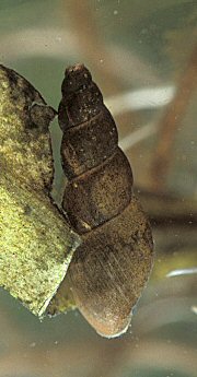
There are a few rarities and other species of interest on Garway Hill which deserve a mention.
The mud snail (Lymnaea glabra) has been found in the wet flushes on the north-west side of the common. This tiny mollusc is listed in the Red Data Book for Invertebrates, indicating it is under threat in the UK. It has become extinct in much of lowland England and is found only in muddy pools and ditches on uncultivated land.
Glow worms can be seen at White Rocks, where the larvae hibernate under rocks and in wood-piles. The best time to see them is after 10.30pm between 25th June and 15th July. Their green luminescence can be seen in the bracken verges as they light up in a mating display.
Thirteen species of spider have been recorded.
Garway Hill also supports several colonies of the yellow meadow ant (Lasius flavus) with their charateristic ant-hills. These provide a useful source of food for the green woodpecker.
There is a lot of bracken on Garway Hill. Recent events have made this the plant species which dominates the eye and it has the immediate effect of shading out other plant life. The leaf litter too can choke out weaker species. However, there are moves afoot to reduce the bracken cover and let the other native plant species recover and shine through, to restore the full diversity of the habitat.
The native turf is described as "acid grassland". Species such as Heath Bedstraw (Galium saxatile), Tormentil (Potentilla erecta), Common Bent Grass (Agrostis capellaris), and Sheep's Fescue (Festuca ovina) prosper in a slightly acidic soil. Commons, which have avoided being ploughed, fertilized and re-seeded have become important havens for this kind of plant environment.
Bluebells are a common sight in
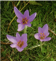
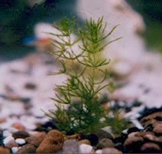
Spring, and a local speciality is the Meadow Saffron(Colchicum autumnale), which shows its pink blooms at the end of summer. The many springs and wet flushes on the hill are home to plants like the Lesser Spearwort, Water Mint, and Brooklime. A complete rarity, Stonewort (Chara globularis) has also been recorded, possibly uniquely in Herefordshire.
The prehistoric enclosure is rare in that it has survived in a clear and understandable form. This feature has high potential to provide more information about early settlement activity on the Common from the prehistoric period onwards. The control and ultimate removal of bracken and gorse from this monument, the other prehistoric enclosure and areas of field systems would be beneficial in order to make the earthwork features more visible.
A second detailed survey of both enclosures should be a priority. This will help highlight the relationships between these features and later features and how they relate to changes in land-use. This survey could be complemented with a geophysical survey in order to identify buried structures within each enclosure. But ultimately the date and use of both enclosures can only be ascertained by excavation.
Garway Hill Common contains a high density of visible archaeological features relating to grazing, agriculture and land management. There is a high potential for the presence of other well-preserved archaeological features and a chronology of flora and fauna.
An intensive study of the common's peat deposit including radiocarbon dating and pollen analysis is recommended. This would indicate not only a chronology of fauna and flora within the area over time, but also indicate whether or not waterlogged conditions within the common have remained constant over time.
A detailed survey of the cottage site should be carried out in order to record the detail of the structure.
Prior to any land management within Garway Hill Common these areas should be subject to a more detailed walk over survey in order to record and assess the location, archaeological potential and significance of any features present.
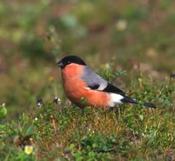 Garway Hill teems with bird life. Local naturalist John Pullen has recorded 70 different bird species in the area. 44 of these species use Garway Hill as a breeding ground.
The Hill is home to seven species on the Red List, meaning their populations are rapidly in decline or threatened : they are skylark, yellowhammer, linnet, song thrush, bullfinch, spotted flycatcher and starling. Other species include redstart, woodcock, green woodpecker, stock dove, meadow pipit, tree pipit, cuckoo, swift, swallow, house martin, dunnock, stonechat, mistle thush, willow warbler and goldcrest. There is a thriving group of Tawny Owls at White Rocks.
Add to this the soaring buzzards and the occasional red kite on a day-trip from mid-Wales and you begin to see what an ornithological paradise is Garway Hill. The ground-nesting species are at risk from the encroaching bracken which threatens to squeeze out the open grassland they require for breeding. It is one of the priorities of the environmental management plan to reduce the amount of bracken cover on the hill, which will promote better conditions for ground-nesting birds.
The most prominent feature from the 20th Century can be viewed at the summit of Garway Hill in the form of an octagonal laid brick wall, approximately 2m high and 7m in diameter and standing upon a concrete foundation with a further eight individual concrete support foundations.
Identified as a Second World War Radio Tracking Station, it was erected in 1942 by order of the Royal Air Force. The whole station stood approximately 8m high, the mixed brick and concrete foundations having supported a timber built tower not unlike that of a windmill. The photograph shown on this page is beleived to be the only one in existence which shows the full structure.
Directly south and west of the tracking tower site are the remains of two foxholes/trenches and a square trench which surrounds the structure shows where a fire-break trench was dug.To the northeast, on the down slope of the hill, are the remains of the barrack blocks. these are similarly surrounded by firebreak earthworks . The foundations of the barrack block are all that remain following its demolition during the 1970's. On the edge of the Common boundary, there are also the remains of the generator block consisting of a concrete foundation with evidence of collapsed brick walls scattered on the interior.
The upper part of the tower was dismantled in 1948, leaving the brick and concrete base as an enigmatic trace of its brief existence.
A fuller account of the history of the tracking station can be found in the book "The River Running By" by Joan Fleming-Yates (ISBN 1 905037 05 8) which describes in great detail the historical aspects of Garway and other places in the Monnow valley.
 |
 |
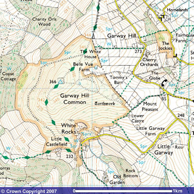
Garway Hill rises to 1202 feet and the Common occupies approximately 200 acres of land draped across its summit like a blanket. The hill is a prominent local landmark, visible from all sides with a distinctive radio mast and "the pimple", the remains of a wartime radio tracking station at the top.
Its topography qualifies it technically both as a mountain (i.e. higher than 1000 feet) and as a "Marilyn" (a hill or mountain with a drop from the summit of at least 150 metres on all sides. For a satisfying, yet not too demanding, amount of effort in climbing to the top the rewards are great, with a 360-degree panorama opening out to take in seven surrounding counties in England and Wales.
Post-medieval settlement
There are visible remains of a cottage site close to the western boundary of the common. These comprise of a rectangular structure 10m by 6m constructed using local angular sandstone. The cottage site is a good example for the post-medieval attempt to claim land from the common.
Other features that relate to post-medieval settlement consist of isolated platforms levelled into the natural slope and usually within close proximity to the quarried areas.
Post-medieval industrial features
The majority of these features consist of quarries and hollow ways. The larger areas of quarrying appear within the south and northwest portion of the common. Within the south quarrying is almost entirely concentrated within the area known as White Rocks. Here intensive quarrying has created a manmade re-entrant into the slope of Garway Hill.
The western slope of Garway Hill is littered, primarily with the remains of quarries, but also with the remains of levelled tracks and some platforms undoubtedly connected to industrial activity.
Though the majority of post-medieval evidence points toward stone extraction there is one feature that may indicate woodland management. A possible charcoal burning platform was recorded within the west of the common on the border of Copse Wood within the Kentchurch Estate.
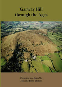 This book is the first publication to be produced under the banner of the Garway Heritage Group. It is the result of a community project funded by the Local Heritage Initiative with money from the National Lottery.
Local historians and residents have combined to tell the story of Garway Hill and its environs in the sweep of events from pre-history to the present day. Within the book's pages there is serious historical research as well as a nostalgic look at some aspects of local life which, although still within living memory, may seem long ago and far away.
This book has its origins in a project originated by the Garway Hill Commoners Association to investigate the remains of an Iron Age settlement on the slopes of Garway Hill. The dig took place in June 2006 with assistance from Hereford Archaeology and the participation of many local volunteers. The success of the dig as a community project spawned the idea of a fuller investigation into the history of the area, drawing on the work of many excellent local historians and the long memories of older residents and their family lore. This book is the outcome.
Many of the chapters focus on the Common itself - covering its history and management, flora and fauna, archaeology and its use in the Second World War. Other chapters feature the farms in the vicinity, the area of White Rocks, the Lordship of the Manor and how this has affected the Common
and its users. You can also read about the ever-changing mix of shops and pubs on and around the Hill, the provision of local bus services, and the many myths and legends attached to this ancient place.
The whole combines to produce a much fuller and vivid picture of events than one might expect from such a small patch of Herefordshire countryside, not least the surprising role that many Garway emigrants to the United States in the 19th century had in the establishment of the Mormon Church and the building of Salt Lake City, Utah.
With old and new poems, a range of historical and recent photographs, many never published before, the book provides a picture - in more than one sense - of Garway Hill and its surrounding area.
Garway Hill through the Ages has been compiled and edited by Joan and Brian Thomas, with contributions from local historians and residents. It is published by Logaston Press, price £10. It is available from all good bookshops. In addition it is available for sale at Broad Oak Garage, Galanthus Gallery in Wormbridge, Gentle Jane's in Grosmont, the St. Weonard's Shop, from any of the GHG Committee members and at our monthly meetings. You can also find it on the Computer Help stall at the monthly Garway Market.
Earthworks on Garway Hill Common that appear to relate primarily to the Medieval period consist of land management features - field boundaries and field systems. There is a series of low stone and earth banks spaced 12-14m apart running down the slope from the Iron Age enclosure which gradually peter out as they approach the Common edge. As field boundaries these are mysterious since the effect of ploughing downhill would, over time, cause the soil to migrate downslope.
There is evidence of a demarcation between parts of the hill used for arable production and as pasture for animals. A sinuous bank and ditch boundary runs from the Black Pool and may mark the extent of intensive farming on the Common during the Medieval period.
Within the west and north of the common there is evidence of strip lynchets or agricultural terraces on the hill slope to aid ploughing. A series of platforms set amongst the lynchets are also enigmatic. Devoid of surface features they give no immediate clue to their purpose, but seem certain from their position to be related to agricutural activities of some sort.
Medieval agriculture on the higher slopes of Garway Hill was probably abandoned for some time following the general population collapse which accompanied the Black Death in the 14th century. In fact the total population of Herefordshire remained below pre-Black Death levels until the 19th century, which placed less pressure on land use for several centuries. Since the lower land in the river valleys was more fertile it made greater sense to cultivate that first, and high level farming became unnecessary.
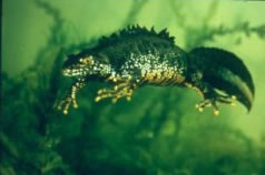 The Black Pool below the crest of Garway Hill is a breeding area for Great Crested Newts. In a survey of August 2005, 19 adults were found in the water.
To encourage the survival of this rare and protected species it is planned to plant some dense hawthorn bushes at one end of the pond in order to give the amphibians cover as they come and go from the water, especially during the breeding season. This is one of the initiatives being promoted by the Garway Hill Commoners Association under its environmental management plans.
Small populations of smooth newts and palmate newts are also to be found in the Black Pool. Reptiles recorded on the Hill include the adder and the slow worm.
The initial walkover survey in early 2006, followed by the topographical and geophysical investigations specific to the enclosure site made it all the more compelling as a dig project. The results were used to determine the best location to place trenches. The topographic survey results were plotted on a plane table to produce scale drawings of the banks and ditches.
The dig took place in June 2006. The geophysical survey within the rectangular enclosure had showed anomalies, which could be the foundations of dwellings, and the survey results were used to determine the location of the 5m x 5m Trench 1 excavation. The objective of this trench was to determine the presence of any features relating to settlement . Excavations were also carried out across the enclosure bank and ditch along the western boundary (Trench 2) and over the enclosure ditch directly east of what was believed to be the original entrance to the enclosure (Trench 3). The aim of the 8m x 2m Trench 2 excavation was to determine the structure of the enclosures defences. Trench 3 was intended to uncover the ditch terminal and any material associated with it. It was hoped that all three trenches might also provide dating evidence.
In Trench 1, the foundations of a round or oval structure were revealed. The interior of the structure had a compact clay floor with charcoal inclusions. The foundations of the structure survive as a partially stone filled foundation cut that may have supported a wood or wattle and daub structure.
Trench 2 revealed the bank and ditch's construction. The ditch was cut into the natural sandstone bedrock, the material produced employed in the construction of the bank that may have had a timber revetment. The ditch was v-shaped and was cut to about.1.5m deep and 3m wide.
Trench 3 clarified the position of the original entrance by unearthing the ditch terminal. The ditch terminal provided the greatest opportunity for the discovery of finds associated to the enclosure. It was v-shaped, and produced two distinct layers of pottery at the base of the trench. Specialist analysis has produced a date of middle Iron Age to late Iron Age. The ditch terminal indicates the presence of the entrance. The ditch was deliberately in-filled with stone material. On initial excavation the trench was covered in a layer of mixed rounded and angular cut stone, this has been interpreted as the collapsed remains of a stone faced rampart. However, the collapse of the material may be deliberate due to its unnatural appearance within the ditch It appears that only the eastern side of the enclosure had a stone revetment against the bank, because excavation across the bank and ditch in Trench 2 did not reveal any stone. The stone fronting at the approaching side of the enclosure may originally have been a sign of prestige, with the aim to impress those approaching from the east and south.
As a community project this dig was an outstanding success. For two weeks in a June heatwave local volunteers came from all around. Friendships were made and new archeolgical skills were learned from the experts from Herefordshire Archeology. On one hand it was a great social occasion, yet it also produced research work of lasting merit which will benefit future generations in understanding the history of the hill. It has also proved to be the catalyst for the formation of the Garway Heritage Group which will continue to explore the history of the area through a mixture of coventional research and further projects like this one. The group has produced a book "Garway Hill through the Ages" which contains a detailed chapter on the dig and what it reveals about human habitation on Garway Hill in the Iron Age.
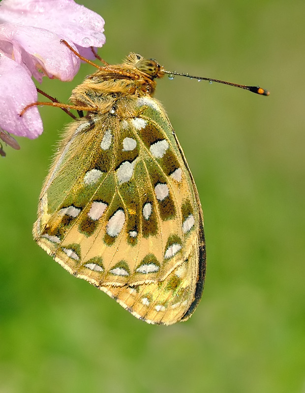 On any calm day from Spring through to Autumn, Garway Hill is a good place to see butterflies. Sit at the top of the hill of an evening and you will be surrounded by many Gatekeepers, Red Admirals, and Painted Ladies, all engaged in territorial or mating activity.
As well as these more common varieties, Garway Hill is also home to the rare Green Fritillary. To gather more information about the butterfly population of the Hill regular monitoring surveys are performed by a local group of amateur naturalists under the supervision of Herefordshire Nature Conservancy. These are being done in co-ordination with the environmental Management Plan operated by the Garway Hill Commoners Association so that the effects on species of the changes put in place under the plan may be measured.
There is ample evidence for the occupation of Garway Hill by early peoples. One of the most prominent archaeological features on the Common is a substantial bank and ditched enclosure settlement measuring about 90m square. The ramparts survive to a height of 2m and are 4-5m wide in places. Although no features remain visible on the surface to indicate any structural presence, the scale of the bank and ditch earthworks might suggest that the enclosure dates back to the Iron Age, and perhaps indicates a defensible farmstead.
This enclosure was the subject of an archeological dig in June 2006, funded by the Garway Hill Commoners Association with financial help from the Heritage Lottery Fund. Expert supervision was provided by Herefordshire Archaeology and volunteer labour was drawn from the local community.
(More about the dig and what was found)
Recent aerial photography has also indicated the presence of a second previously unknown settlement enclosure in the southwest sector of the Common. This smaller, at 30m square, and has only 3 sides clearly delineated. The interior is of particular interest as the slope of the hill has been levelled into a series of terraces, one of which shows traces of the remains of a stone structure or its foundations. This enclosure has not been the subject of any prior archeological investigations.
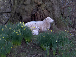 Garway Hill remains a working hill as well as a favoured place of recreation and nature study. The Commoners have long-established rights to graze animals on the common land, Stock is kept on the land in all seasons, mostly sheep and ponies.
The sheep are a hardy Welsh mountain breed, self-sufficient and able to live on the hill year-round in all weathers. They have complete freedom to roam. If you are visiting the hill with your dog, please be aware that you should keep it on a lead at all times. Visitors' dogs have been known to kill and injure the resident sheep.
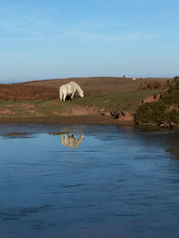
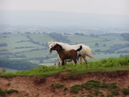 The white horses are also from mountain stock They are used for breeding with other varieties of horse to add a bit of strength and a hardy constitution to the offspring. Mares with their foals can be seen at virtually any time of year. Often the foals are chestnut in colour and very different in appearance to their mothers. Although the horses may allow you to get quite close and appear indifferent to your presence they are unlikely to let you touch them and you should not try to feed them. Be specially careful approaching a mare with a foal as these horses are protective parents.
Prior to any disturbance of the ground to investigate archaeological remains, it was important to carry out appropriate survey work. On Garway Hill Common, the following types of survey were carried out in order to identify features of interest and locations for excavation :
1) A walkover survey across the Common in late April and early May 2006 with a hand held Global Positioning System (GPS) unit was used to record the location of features encountered. As the vegetation upon much of the Common consists predominantly of bracken with very little open grassland, this made some areas rather inaccessible. Survey coverage was therefore not complete. Nevertheless, the walk-over survey identified many features within the Common that served to illustrate the intensive use of the land resource through the prehistoric, medieval, post-medieval and modern periods, i.e. quarries, lynchets, earthworks, settlement features and hollow ways.
2) Topographic surveys were carried out in mid-May 2006 of the previously-known rectangular enclosure on the eastern side of the Common and of a smaller enclosure discovered during the walk-over survey near the southern edge of the Common and the area known as White Rocks.
3) A geophysical resistivity survey also took place in mid May 2006 within the larger enclosure to try to identify any subsurface features. This showed some useful anomalies, which were conjectured to be the foundations of dwellings and other features, and the results were subsequently used to determine the location of the trenches which were dug when proper excavation got under way in June 2006.
The locations of all features recorded on the initial survey and the results of the geophysical examinations are shown in the full report produced by Herefordshire Archaeology.
Download the Full Report (.pdf, 462kb)
 Historically, the Commoners were local farmers and smallholders who were granted the right by the Lord of the Manor to use the space of Garway Hill Common for grazing and other agricultural activities. Commoners' Rights have been in existence for centuries and are attached to particular properties, so they can be passed on when the property changes hands.
Today there are 17 properties on or near Garway Hill Common which have Commoner's Rights attached to them. Over the years changes in ownership of these properties have meant that today only a minority of Commoners actually exercise their rights.
In times gone by, the management of the Common would have been handled by the Reeve, a senior servant of the Lord of the Manor in charge of managing the Lord's estates, who would enforce the rules which governed the Commoners' activities. As the large estates broke up, many in the 1920's, this central control mechanism began to break down. In the case of Garway Hill Common, although there was still a titular Lord Of the Manor there was no estate left to manage and no Reeve to do the enforcing. The Lord of the Manor died and his successors moved away from the area.

This pattern of change was repeated all over England and many Commons suffered as a result. In the 1960's legislation was brought in to create a national register of Common Rights to try to improve matters and efforts were made to contact the Lord of the Manor at the time, but without success. As a result the Parish Council was given registered ownership of the Common, since in the absence of a known owner a local public body had to take responsibility. In practice though, the Commoners were left to do what they had always done, but without central co-ordination and control.
With changing patterns of property ownership on the Hill, the number of Commoners putting livestock on the Hill declined, so the bracken-covered areas gradually expanded. The final blow was the national foot and mouth outbreak of 2002 which badly affected local farmers. Livestock vanished from the Hill for an extended period and the bracken was given free reign.
The Garway Hill Commoners' Association was formed in December 2004 to arrest this decline. Its aims are to improve the Hill both as a local farming resource and a place of quiet recreation. With the help of funding from the Lottery Heritage Fund and central government, the Association will put in place a comprehensive environmental management plan which will safeguard the future of Garway Hill as a special place for generations to come.
Ancient Rights
Grazing : The right to make use of the open grassland of the Common for grazing animals. Horses and sheep are seen today, and cattle too in recent memory. The total number and type of animals each Commoner may graze is laid down in the Commons Register.
Pannage : The right to turn out pigs on the Common. Pannage is an ancient practice to fatten pigs and the pigs turned out ate the green acorns and beech mast which are poisonous to cattle and ponies. There is no Commoner with pannage rights in the current Register.
Estovers : This is the right to cut wood for fuel. The wood must be burned in the house and the right applies to the hearth, not the land as do other rights. Should the hearth be moved or destroyed then the right lapses. It can be revived by rebuilding a hearth in the exact position of its predecessor.
Turbery : This right also belongs to the chimney and hearth of a property, not to its land, and allows the cutting of turf for fuel for use only on that hearth.
For a fuller account of the History of the Manor of Garway and Commoners' Rights see "Garway Hill through the Ages", complied and edited by Joan and Brian Thomas, available from bookshops or direct from the Garway Heritage Group through this website, price £10.
Under a project created by Herefordshire Nature Trust with the support of the Heritage Lottery Fund, a total of twelve commons in Herefordshire have been targeted as part of the Community Commons Project. Garway Hill Common is one of these.
The overall aim of the Project is to record and measure the level of biodiversity upon the common land in order to form a management plan for each common to improve and promote the habitat of local fauna and flora as well as improvements to public access. The project also provided the opportunity to document and record known and previously unknown archaeological features within the Common landscape through a series of rapid survey assessments and specific investigations.
Commons are areas of high archaeological potential because they have seldom been subjected to the types of disturbance associated with intensive modern agriculture. Relatively little information about archaeological sites within common land in Herefordshire has been recorded in the past. The rapid survey assessment centres on the recording of archaeological features and their position within the landscape. Once the visible archaeological traces within each common have been documented and understood, the results can be combined with ecological records. From these, a well-informed management strategy can be developed to preserve and interpret the archaeological record alongside the other aims of the Community Commons Project.
The archaeological survey and investigation of Garway Hill Common, which has an area of 84.5 hectares, was selected as a pilot study for the Project. The fieldwork was carried out in spring and summer 2006 by local volunteers under the supervision of archaeologists from Herefordshire Archaeology, which is Herefordshire Council's archaeology service. Through autumn 2006, the archaeologists examined and documented the finds and produced a written report.
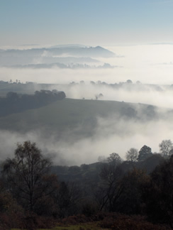 The 85 hectares (about 200 acres) which comprise Garway Hill Common are home to a wide variety of interesting plant and animal life. Although the grassy areas continue to be grazed by livestock, the hilltop Common represents a type of habitat which is much rarer today than it would have been 100 years ago. Because it has not been subject to the sort of intensive agricuture which has become the norm elsewhere in country areas of Great Britain since the Second World War, the local environment remains relatively diverse and contains a number of rare species.
At first glance you may see bracken and not much more, but scratch the surface and look closely and there is plenty to interest any naturalist .
 The Management Plan has been implemented by The Garway Hill Commoners Association to improve the natural environment of the Hill and create more open grassland in order to make better grazing available to livestock. The Plan has its origins in the devastation suffered by farmers as a result of the national outbreak of Foot and Mouth Disease in 2002. This hit the local area particularly badly and for more than a year Garway Hill was empty of livestock. Without the animals, or any human visitors, the bracken grew completely unchecked.
When livestock farming was able to return to the Hill, the remaining areas of open grassland were under severe pressure and doubts were expressed about the viability of keeping animals on the hill. This might have brought to an end a farming tradition that had survived for centuries, and utimately might have made any sort of recreational access to the hill difficult, so a few of the Commoners decided to do something about the situation. The Garway Hill Commoners Association was formed in 2004 with the express aim of improving the grassland habitat of the Hill. Membership of the Association is now made up of all local residents who have Common Rights on the Hill.
The Association has successfully applied for a grant from Natural England to establish a Higher Level Stewardship Scheme (HLS) on Garway Hill Common. This is the corner-stone of the Management Plan, since it makes available an annual sum of money to pay for bracken clearance and other works designed to stimulate improvement to the natural environment and the quality and availability of open grassland for stock grazing.
Over the ten-year period 2007-2017 the aim is to reduce bracken coverage over the area of the Common by as much as 40%, promoting diversity in its plant life by allowing natural wildflower species to show through and improving the quality of the grass sward. This in turn will allow ground-nesting birds such as the skylark to prosper. In order to ensure that the new open areas can be established in this way without over-grazing, Commoners have agreed that animal stock numbers will be held at 2006 levels for the duration of the Scheme.
Other aspects of the Scheme include the filling of gaps in the Common's boundary hedges and improving the lot of the breeding colony of rare Great Crested Newts which inhabits the Black Pond near the summit of the Hill. There is also provision for a series of organised Educational Visits to the Common. Local schools and other groups will receive a guided tour of the Common, focussing on its history, its flora and fauna and its present day uses
The Commoners are local property-owners who have historical rights to use the land of the Common. These might include the right to graze animals, to gather turf and firewood for fires, or food for pigs. The rights were granted in perpetuity by the Lord of the Manor in olden days and are still attached to many of the dwellings around Garway Hill today.
Although these rights were once valuable - essential even - in a subsistence agricultural economy , nowadays many Commoners do not exercise them. Local farmers who are Commoners still graze their stock - sheep and ponies - on the hill, but many local residents who have become Commoners through moving into the area are not actively involved in agriculture.
This gradual shift has made a difference to the natural environment on Garway Hill. As the number of grazing animals has declined, the bracken has taken over from what once were open grassy areas. This has greatly reduced the capacity of the Common to support animal stock. Indeed if all the Commoners suddenly decided that they would exercise their rights there would be insufficient grazing available.
![[i]Ewe and lamb[/i]](/images/commoners/ewelamb.jpg)
The Garway Hill Commoners Association meets regularly to discuss matters affecting the resources and natural environment of the Common. To safeguard the natural resources of the Hill funding has been sought from central government to implement an Environmental Management Plan. This will enable work to be done to maintain the open grassland areas so that stock can continue to use the Hill for grazing, while also encouraging rare species such as Fritillary butterflies and Great Crested Newts to flourish.
Garway Hill has been a special place for thousands of years, and continues to draw visitors today. With funding from the Heritage Lottery Fund, in 2006 the Commoners Association organised an archaeological survey of hill. This covered three thousand years of Garway Hill history, and included an investigation into the Iron Age settlement near the summit.
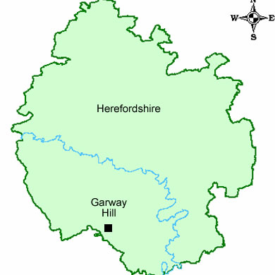
Garway is a village in southwest Herefordshire, lying approximately equidistant from Hereford, Ross-on-Wye and Monmouth. Above the village stands Garway Hill, a prominent local landmark rising to over 1200 feet.
![[i]White horses on Garway Common[/i]](/images/commoners/whitehorses1.jpg)
The land in the vicinity of Garway Hill has traditionally been owned by the Lord of the Manor of Garway although over the course of centuries the large farming estates have been sold off and broken up. The top of the hill used to be regarded as the Waste of the estate, unsuitable for intensive agriculture and over time the upper reaches gained the status of being a Common - an area of land which still remained in the possession of the Lord of the Manor, but over which some rights of usage had been passed to local residents. This situation has continued to this day and Garway Hill Common is still used for limited stock grazing by local farmers and residents.
From the top of the Hill there is a view of seven counties in a 360-degree panorama. White mountain horses graze there most of the year and raise their foals amongst the bracken. Sheep roam freely. A pond near the summit provides a water supply for the animals which lasts all the year round, despite there being no visible source to keep it topped up. The pond is also home to a protected species of newt.
The hill teems with bird life - 70 species have been recorded here - and there are butterflies in profusion. All this nature is being encouraged by a land management plan organised by the Garway Hill Commoners' Association with funding from Natural England. This seeks to improve the natural environment and the Hill's grazing qualities by reducing bracken cover. Over time, the plan will deliver more open grassland, which will in turn promote improved plant species diversity and encourage endangered species of ground-nesting birds to flourish.
![[i]Looking towards Garway Hill (Mike Hallett) [url=www.geograph.org.uk]Geograph[/url][/i]](/images/page-images/commoners/commoners.jpg)
This part of the web site has been produced by the Garway Hill Commoners Association. It describes the work of the Association to improve the natural environment of Garway Hill while retaining the hill's ancient purpose as a local farming resource for stock grazing. Commons are special places, and Garway Hill Common is more special than most.
The hill has been used for agriculture since the Iron Age but has managed to avoid the intensive farming methods of elsewhere, so it manages to retain the air of a bygone age. Visitors to the summit come to enjoy a 360-degree panoramic view of seven counties (on a good day!) and mingle with free-ranging sheep and horses. Although it rises to just slightly more than 1200 feet high, locals would agree that it is the closest place to heaven they know.